


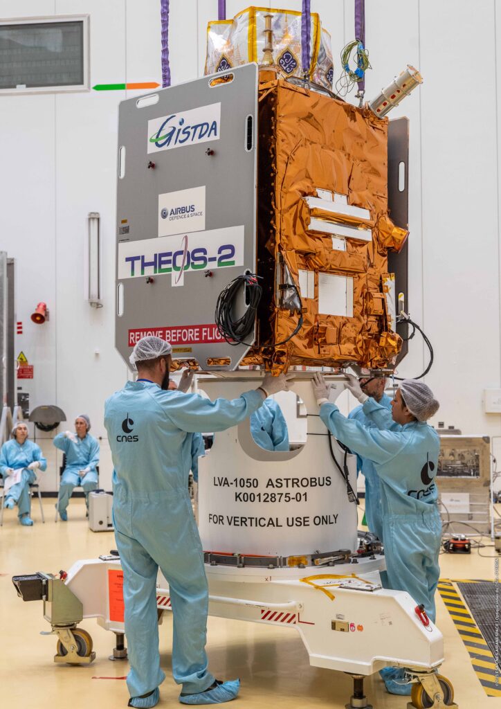
Ms. Supamas Issaraphakdi, Minister of Higher Education, Science, Research and Innovation, said that THEOS-2 satellite is one of two Earth observation satellites under the Development Satellite System Project. operated by the Geo-Informatics and Space Technology Development Agency (Public Organization) or GISTDA, which has the potential to take and produce very detailed color images at a level of 50 centimeters, able to take pictures and send data back to ground stations of no less than 74,000 square kilometers per day.
And data from satellites will be used to update (Update) information in all areas of Thailand to be current, detailed and accurate. Helps plan area management that responds to various emergency situations. effectively Can be used in agricultural management Water management natural disaster management city management and natural resources It also helps develop and upgrade the country’s space technology infrastructure. Especially in human resources and space industry development. which is an important part in the economic development of the country
For THEOS-2 data, GISTDA will provide opportunities for both the government, private sector, and educational institutions. have access to information So that it can be used for further development or commercial services. This will promote the development of the domestic economic system. Including being a driving force to drive education forward. Research and innovation in the use of spatial data and space technology in knowledge development Create innovation developers at all levels, from youth to startup SMEs and large private companies, according to the policy of AWA that focuses on creating people, creating knowledge, and creating innovation. to develop the country
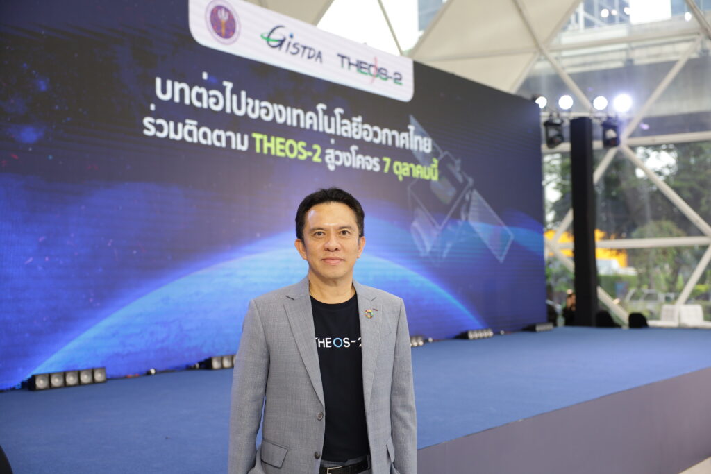
This launch of THEOS-2 satellite is a historic event for the future of Thailand. Because it is the launch of a satellite that will lead to upgrading the country’s development model through the use of advanced technology. As a representative of the government that oversees the country’s space agencies and the Thai people will also join the trip to launch THEOS-2 satellite this time. This is because the government attaches great importance to the successful launch of this Thai ultra-high resolution satellite into space. On this occasion, we would like to invite all Thai people to join in sending encouragement to the GISTDA team and Thailand in successfully sending THEOS-2 satellite into space. Because this launch of an Earth observation satellite is considered the first launch of a very high resolution satellite in Thailand.
Once the THEOS-2 satellite enters space, it will take another 5-7 days to adjust itself to its actual orbit. And it will take approximately 6 months to test various systems before opening for service. The THEOS-2 satellite will help strengthen Thailand’s capabilities in developing space technology and geoinformatics, with the Ministry of Natural Resources and Environment pushing for it. Thailand’s space economy policy to become a reality quickly
Dr. Pakorn Apaphan, Director of GISTDA, said that THEOS-2 satellite will be an important tool for the government in managing the country. Especially in terms of improving the quality of life of the people. It also strengthens the country’s competitiveness in space technology and geo-informatics.
Mapping Because THEOS-2 satellite can record images and have a resolution of up to 50 centimeters per pixel and develop them into three-dimensional data. Therefore, it can be used to produce maps of most scales up to a scale of 1: 1000.
Agricultural and Food Management TheOS-2 satellite can be used to analyze and assess planting areas Classification of agricultural crops, plant health, and prediction of upcoming yields. These qualities will lead to increased agricultural production covering at least 13 main economic crops, both in quantity and quality. as well as effective forecasting of production in advance This will enhance economic stability and a better quality of life for farming families.
Holistic water management Data from THEOS-2 satellites can be used to track changes in water sources and water source types across the country. Used to check information on water sources. Calculating the water volume of water sources is cost. And because THEOS-2 is a satellite with a resolution of 50 centimeters, it can detect water sources with dense weeds. Field water management to create economic stability for farming families and industrial water management that increases good environmental quality. Reduce pollution and its impact on people’s health and the ecosystem.
natural disaster management The obtained THEOS-2 satellite data will be used for timely planning, prevention, warning, evacuation, and mitigation of problems arising from natural disasters. or when the situation has already occurred This information will be very useful for spatial damage recovery. and compensation for those affected in order to ensure fairness to all parties involved in order to provide the people with higher safety and a better quality of life.
Urban management, especially land boundaries and border boundaries Data from THEOS-2 satellite will help increase the efficiency of managing the country’s important infrastructure, such as water management projects. High-speed rail network project Linking former industrial zones with infrastructure This will reduce the problem of inequality in access to public service systems. Whether it is public health, education, travel, and water resources.
Management of natural resources and ecosystems Data from THEOS-2 satellite gives us a broad view of the problem. It is a proven fact. This information will be very useful in helping to increase forest cover. Including increasing the efficiency of forest encroachment prevention and community forest management based on the balance of coexistence between forests, including terrestrial forests, mangrove forests, and communities, in line with maintaining the stability of the natural resource base and environment. Including being used to monitor carbon absorption and release, data from satellites will be used in the carbon measurement and evaluation process that is standardized, fast, accurate, and transparent according to international standards.
The launch of THEOS-2 satellite into space is considered to be Thailand’s second launch of an operational satellite that can actually be used for missions in the country in 15 years after Thaichot was launched in 2008. As Thailand Having THEOS-2 satellite will be the answer to the long-term sustainable development of the country.
especially Using satellite data to reduce inequality in various dimensions, especially the economy. This is an important problem that Thailand is facing because the “economy” is the mouth of the people. It will be an important mechanism to drive the country forward. GISTDA, as an agency under the Ministry of Natural Resources and Environment, is ready to support and promote the use of this satellite data in solving problems. Both in the dimension of solving spatial problems and in the dimension of area development to create sustainable development in Thailand.
